Pegasus Caving Club
aka Pegasus Club Nottingham
Caves & Caving in Panama, a Personal Account. James S. Cobbett.
Introduction
In 2001, when I went to live in Panama, Marilyn’s, my wife’s, home country, I had already been visiting the country for nearly twenty-five years, and, in spite of my best efforts, it seemed likely that Panama was a cave-free zone. I therefore left much of my caving gear in England, and bought a sailing boat instead. However, as will be apparent from the map below, which is current as of mid-2009, “cave-free” is not how Panama turned out to be!

Before running through the various caving areas and caves, there are a few things to be kept in mind about caves and caving in Panama :
Panama runs West (Costa Rica) to East (Columbia), with the Atlantic, aka “Caribbean”, to the north and Pacific to the south.
Much, if not most, of Panama is not fully explored, or readily accessible – by “readily accessible” I mean within 2 hours, on foot or on horse-back, of a 4 x 4 drivable track, water-taxi/motorised canoe ride, or air strip. Darien remains largely “terra incognita”, with no way through to Columbia, though, many years ago, John Blashford-Snell did get a Range Rover through to Columbia, taking one hundred days, with support from Messrs Land Rover and the British Army.
Panamanians are reluctant to involve themselves in anything energetic, especially outdoors. They are not interested in caves, making it pretty much impossible to get together a posse for anything much more than a “beginners’ trip” within day-trip range of Panama City. This means that an “international expedition” is required for serious exploration.
By far the best way to locate caves is to “ask the locals” – assuming you speak Spanish, of course. Without exception, whenever I have been told “There’s a cave over there”, there always has been!
Logistics are key - the caving is usually easy, the hard, and fun, part is getting to the entrance! The 2006 and 2009 expeditions (Pat Cronin (Irish CoastGuard), Connor McGrath (ICG), Dig Hastilow (CDG) and myself, and in 2006 Ray Murphy (ICG) & Phil Collett (SMCC)), to get around used :
Helicopter,
4 x 4,
Horses,
Sailing yacht,
Inflatable with outboard motor,
Scheduled light aircraft flights,
Water taxi,
Motorised canoe, and
Our feet.
The limestone in Panama is thin, maybe 120 feet maximum thickness. As a result the known caves are all shallow, generally have multiple entrances (e.g. sky-lights where the roof has fallen in), albeit with big passages, and are short - the longest, Nibida, being only about 2 kms in total.
Tropical rain forest (having often to machete a way through the jungle), combined with the climate (30° C, 100% humidity – when it’s not actually raining), the topography, and the surface clints and grikes common in karst areas, makes for hard going – especially for the “more mature” caver. The jungle is in many places so thick that one could walk within 10 metres of a surface shaft, and miss it.
The heavy rain, large passages and many entrances, mean that lots of things get washed into our caves, such as tree trunks, crocodiles & snakes. When a friend reported recently that he had found “a lot more branches in Cueva Las Tres Cascadas”, this did not imply more passages!
In our caves, we have more bats than they have in Lord’s Pavilion!
The best time for outdoor activities, such as caving, is the “Summer”, that is December through early May.
In Panama, we speak Spanish.
If the above is the “bad news”, there is “good news” too, notably that the booze, and most everything else, is very cheap, and that were you to fly in to-night, I could just about guarantee being in “new stuff” by to-morrow evening!
In 2002, I was introduced to Keith Christenson (NSS), an American caver, and tropical bat specialist, then resident in Panama. He had started on a systematic investigation of caves in Panama, and, though now back in the USA, is still the keeper of the “Panama Cave Registry”. Though he had involved a number of locals in the “Panama Cave Project”, and found, explored and recorded a large number of caves within day-trip range of Panama City, lack of qualified/experienced support left him with a number of open leads, and a number of unconfirmed “cave sightings”. With support of cavers from the USA, he had also explored some caves in Western Panama, near the border with Costa Rica, and also some caves in Bastimentos, an island in Bocas Del Toro, where Panama’s longest caves are to be found.
My explorations have been largely built on foundations laid by Keith, and I am most grateful to him for pointing me in the right direction. Keith continues to interest himself in Panama, and I hope to see him back here before long.
Though the following may attempt a comprehensive and up-to-date account of caves in Panama, this is very much a personal saga, more from “From the Log Book”, than a UBSS occasional publication.
Taking it area by area, and west to east :
Western Panama
I have not been caving in Western Panama, though Keith Christensen et al explored and surveyed a number of caves here in the Oligocene Senosri-Uscari limestone, the longest of which, at 707 metres, is Cueva Porton.
Rio Teribe
River Teribe flows north into the Caribbean (i.e. Atlantic) from the highlands of La Amistad (“Friendship”) National Park, which spans the border with Costa Rica. Though there are no recorded caves here, there are known caves in Bocas Del Toro to the east, and Western Panama to the south, making it possible that there might be caves here too. In 2004, in spite of Lonely Planet’s warnings of “snakes like fire-hoses”, Marilyn and I ventured a couple of hours up this huge river, initially in a motorised canoe, and then on foot. The locals did, indeed, tell us of caves further up river, the entrance to one of which had been filled-in, to keep an evil spirit bottled-up. This would certainly make for an interesting expedition, for which one would need to allow several days. However, with the development of hydro-electric generation capacity on the Rio Teribe, access should improve.
Bocas Del Toro
Bocas is an archipelago of Caribbean islands, discovered by Christopher Columbus on his fourth and final voyage to the Americas in 1502. Panama’s only show cave, La Gruta (“The Grotto”), is located on Isla Colon (“Colon” is Spanish for “Columbus”), and in 2001 Keith Christensen surveyed Ol’ Bank Underworld, on Isla Bastimentos, then Panama’s longest cave, at 1,146 metres.

One of the Rio Mimitimbi River Caves
In 2005, Rob and Helen Harper (“BEC”), Mac McManus and myself returned to Bocas Del Toro, and passed a waterfall and duck, to extend both main inlet passages to extend Nibida, an active resurgence cave on Isla Bastimentos, to be Panama’s longest known, and surveyed, cave. This expedition also opened-up Isla Colon for caving, where a number of previously unrecorded caves were explored, including Cayman Cave, named for the cayman (a brand of small crocodile) that calls this cave home. Cayman Cave resurges into the Rio (river) Mimitimbi, which itself flows through a number of short river caves, one of which is shown to the left, big enough to drive an amphibious bus through. This expedition has been previously described by me in “Panama 2005” (Journal of the Wessex Cave Club, xxxxx 2005), so will not be further detailed here.
In 2006 I returned to Bocas with a new crew (Pat Cronin, Connor McGrath, Ray Murphy, Dig Hastilow and Phil Collett), again using my sailing boat, Flying Scud, as a caving hut. Having been shown, by the National Park warden, Domingo Villagra (pronounced “Viagra”, and butt of a number of inexcusable jokes), a new cave entrance in the jungle in Isla Bastimentos, this was forced through to connect with the Nibida main stream passage, to extend Nibida to circa 2 kms. A 12 metre tight and nasty surface shaft, named Perseverance Pot, first noted during the 2005 expedition, was dropped, to by-pass the “too tight” sump dived by Pat Cronin at the end of Domingo’s Cave, another resurgence near to Nibida. This gave access to the, large and well decorated, Domingo’s 2 streamway, with sumps at both ends. Domingo’s, named for the local hard man, takes the water from Ol’ Bank Underworld - the Ol’ Bank Underworld/Domingo’s system would likely be the longest in Panama, were these to be joined; a project for another day! Some cenotes, flooded pots, were visited to the south of Bastimentos, which could doubtless be readily connected by diving. A number of other leads were explored and surveyed, with much potential still remaining, including one cave which the locals did not care to show us, due to the resident dragon!
On Isla Colon, Dig Hastilow dived another cenote (“Cenote Courtney”) to the north-east of the island. This gave access to two flooded passages leading off, to a maximum depth of circa 5.5 metres, still continuing wide open. As we had only one set of diving kit, and this was but a recce, the sump was not pushed, leaving an interesting target for later investigation.
To get ourselves more time for cave hunting around the headwaters of the Rio Mimitimbi in Isla Colon, we took jungle hammocks to sleep one night in Cayman Cave. Having discovered, and explored, Rio Mimitimbi River Cave (52 metres) and Rio Mimitimbi Resurgence Cave (12 metres), we scampered past the resident croc in Cayman Cave, and set up hammocks in a large dry oxbow, above the main stream. After dining on self-heating MREs (US Army issue “Meals Ready to Eat” - not bad at all), we all dropped off to sleep - all except for Phil Collett that is, who had the hammock nearest the stream and the croc, and was worried about it! However, the croc it was who came off worst. After a few hours, the MREs had worked their way through, and one of our crew (no names, no pack drill!) found he had to relieve himself in the stream. When he had finished his business, he heard a noise, and looked down to find that the cayman, likely on a nocturnal crayfish hunt, had copped the lot!
The cave had it’s revenge on me, however, as it was most likely here that I picked up Weil’s Disease, which put me in hospital in Panama City for eight nights, with total kidney failure. I recovered completely, but we all took Doxicycline as an anti-Leptosporosis prophylactic on the 2009 expedition.
Though a number of open leads, and rumours of caves, remain on Islas Colon and Bastimentos, no “real” cavers have been back since 2006. Bocas Del Toro is an attractive and popular tourist destination, with many hotels, hostels, restaurants and bars, making this an obvious and easy target for another time.

The Croc That Cronin Crapped On
The Azuero Peninsula
Though no caves were known in the Azuero Peninsula until recently, a number of caves have been explored there in the last five years. Some ten miles headed north-west out of Tonosi, the road passes a cement works and limestone quarry. A number of caves have been explored in this area, the longest of which, Cueva Quebrada la Mocha, was surveyed at 206 metres, by Keith Christensen et al, in 2005. (This was a university-funded expedition, to obtain some speleothems for global warming research purposes, but which found nothing worth taking home. Why didn’t I think of something like that?).
The road branching south from the Pan-American Highway, just before Santiago, via Atalaya and Ponuga, to reach the Pacific at Mariato on the western side of the Azuero Peninsula, provides access to more caves. I was shown El Tunel (“The Tunnel”), a fine but short (53 metres) stream cave, near the road bridge over the Rio Pocri, in 2004, and Keith explored a few caves in 2005, from the coast road, heading south from Mariato.
In 2006, I was asked to take a look at a gold prospect off the road to Mariato. While I was there, I was told about a nearby cave that had been entered by two children long ago, only one of whom had returned - the standard Panamanian tale, the local equivalent of the dog that disappeared down Swildons, and came out at Picaddily Underground one week later, with his hair all singed! In 2009, we decided to leave Bocas Del Toro alone for once, and concentrate on other leads instead, including the “Cave of the Lost Children”.
A passing local was happy to show us the entrance to this, and three other nearby caves, close to a (4 x 4) drivable track. The Cave of the Lost Children proved to be a sink at the bottom of a small valley, dry at the time of our visit. The sink-hole led directly into the large passage shown below. The cave branched, with both ends leading to sumps, static at the time, but which take a lot of water in the rainy season. The total surveyed length was almost 400 metres. As with almost all Panamanian caves, Cave of the Lost Children is home to many bats.
James & Bats Cave of the Lost Children
Two other sinks, within a couple of hundred yards of Cave of the Lost Children, were also explored, but only went about twenty-five metres each. Though we had been shown what is likely the entrance to the resurgence cave for at least two of these sinks, time (and idleness) did not allow us to look at this. If there are four entrances within a two hundred yard radius, there must be more caves in this area, and also down on the coast, where reports of entrances were not followed up. Again, this area has to be worth another visit.
Chiguiri Arriba
Though at this writing uncertain as to whether it is really limestone or not, Chiguiri Arriba is in an area of what appears to be cone karst. A small “eco hotel” looks over the jungle, with mountains extending as far as the eye can see. During an earlier visit, in 2006, the hotel guide had told me of caves in the area, and an offer to lead us to them was repeated during the 2009 expedition. However, these caves are said to be some hours, on foot or on horse-back, away, and as it was pissing down with rain, and we had already had more than enough fun getting out of Boca De La Encantada, see below, we declined. However, most likely there are caves in this area, just waiting to be discovered!
Boca De La Encantada
Some years back, Keith Christensen told me that, decades ago, some American geologists/archeologists from the Panama Canal Commission/Smithsonian Institution had visited a village named “Boca De La Encantada” (“Mouth of the Enchanted” – a promising name!), when scouting out a route for a new canal. They had been shown a large cave, which two children had entered long ago, etc… The Americans had penetrated some fifty metres, with the cave continuing. Though Boca De La Encantada is shown on the maps of Panama, there is no road anywhere near – so how to check this out?
In January 2006, I made a recce using a Jeep Cherokee with lifted suspension. I reached a point from where I reckoned that two hours walk should take me to the river, where I could hire a local canoe for a two hour ride, which would only leave a further couple of hours walking to reach the fabled land! This was the expedition that we had planned for 2009. However, a month before the team arrived, my wife’s cousin introduced me to Angel Brennan. Angel works on rural development projects for the government, had been to Boca De La Encantada once already in 2009, and was hoping to find someone crazy enough to accompany him for the return trip.
The first day in Panama, the rest of the team made a helicopter recce of the Boca De La Encantada area, confirming that there is a lot of jungle, many rivers, and few good tracks. No karst features, not even some shake-holes interpreted from aerial photos, could be identified.
Following a two hour drive to Penonome, a former capital of Panama, and a night in a hotel, we met Angel at nine in the morning, and headed North in two 4 x 4s. After two hours driving in gradually deteriorating driving conditions, including one river crossing, we had to stop for one hour to improve a soft spot in the road. In spite of our best efforts, we then had to spend a further hour pulling Angel’s car out of the mud. Fortunately, Angel had arranged for eight horses and six “minders” from Boca De La Encantada (which is within cell fone range) to meet us, enabling us to press on, though this was the first experience of this mode of transport for most of us. Two river crossings, and four hours later, on the worst tracks imaginable, we arrived in Boca De La Encantada, just as it was getting dark, passing no obvious limestone or karst on the way.

Cueva Boca De La Encantada
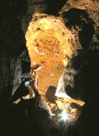
After feeding us, we were shown to the village “Guest House” – wooden beds, no mattresses, so I used a jungle hammock. The next morning, after breakfast, we were loaded onto horses again, for a ride of little under one hour, after which we were led on foot down into a much-karstified limestone gorge, with the Rio Boca De La Encantada flowing down it. After a third of a mile, the river resurged from a cave mouth, as shown on the left.
The large passage was generally chest high in water – though Cronin had to swim! After circa 80 metres, a large inlet passage/shaft to surface was passed on the right. A climb over a tree trunk choke led, after a total of less than 200 metres, to the upper, sink, entrance, again largely choked with tree trunks. I walked upstream of the sink with Dig Hastilow, to see if there were any other caves leading off the valley, but the limestone/karst ran out within a few metres. On returning to the sink, we were collared by one of our minders from the village, who insisted that we not return via the cave, because the rest of our team were now on top waiting for us. They has similarly been persuaded to come and meet me - I think the real reason was that it was lunch time! After lunch, I festered, with a detached boot sole, whilst the others took fotos (successful) and looked for my spectacles (unsuccessful). In the evening, back at the village, we reported our success, and also that we had seen no signs of lost children, treasure, dragons etc.
We left a number of open leads in the cave, so a return trip may be warranted, or alternatively, just wait for a day when the ambient temperature is 30° C, and go down Port-Yr-Ogof instead!
Though it had been raining whilst we had been in Boca De La Encantada, the next morning dawned bright and clear. However, the tracks that had seemed desperate to us on the way in, were now so bad that we avoided the worst of the track via fields, and had an easier return to the cars, only stopping en route in Boca De Tulu for coffee - grown very locally, and ground in a 3 foot high wooden pestle and mortar while we waited!
However, once we were back at the cars, it was very obvious that the track was much muddier, and much slicker, than it had been two days earlier. Then, Angel’s 4 x 4 Mitsubishi pick-up would not start – first it looked like a flat battery, then it became clear that the starter motor was U/S! Using a very long caving rope, and going as near as I dared without getting stuck, I managed to pull start Angel’s car, with mine. A few miles down the track, in appalling conditions, Angel’s car stopped again – and there it remains!
A couple of miles further on, sliding sideways at 30 MPH, my 4 x 4 sank into the mud, so deep that I could not even get the door open. Two hours digging, including cutting off the back bumper with a machete, resulted in the following exchange with a local spectator :
Campesino, to James : “Look what you’ve done to your Mitsubishi Montero!
James, to Campesino : “It’s worse than that, it’s not my Montero, it’s my wife’s!”
Eventually the locals managed to pull us out. Next time, on a bend, was worse, it taking eighteen men, plus two horses, to pull us free. We stopped at the last river crossing, just as it was getting dark, to wash off, then had a meal that Angel had arranged for us, then back to the hotel in Penonome, in time for a few beers.
Though we were told that there are no more caves near Boca De La Encantada, we were told of some accessible from the track between Penonome and the first river crossing - i.e., where the track is in reasonable shape, and not too far from Penonome. A return trip should be made to check this out, and also to make a more thorough exploration and survey of Cueva Boca De La Encantada. This deserves another visit, if only for the fantastic journey in and out!
San Lorenzo National Park
Though the Spanish had built a fort, San Lorenzo, at the mouth of the Chagres River many years before, this did not prevent Captain Morgan from trashing the fort, and then moving on to sack and loot Panama City in January 1671. The area around the mouth of the Chagres is now a national park, and boasts a couple of interesting known caves – though there must be more.
Cueva Las Tres Cascadas, “Three Waterfall Cave”, may be approached via a “hard v. diff” jungle bash, terminating in a 200 foot abseil down a waterfall, in a real “Lost World” setting. How do I know that this is 200 ft – well being the first to attempt this drop, on a 175 ft rope ……..! The waterfall leads within 100 metres to a wide, climbable, surface pot, with three waterfalls into the cave. Keith Christenson was shown this entrance by Bill Bailey, a “Zonian” (i.e. A US national, borne and brought up in the former Panama Canal Zone), and penetrated via a little over a hundred metres of big passage to the top of a 40 ft wet pitch, where he was stopped due to lack of support. I subsequently bottomed the pitch on rope into a deep pool, and then followed via a winding awkward rift, to a lower entrance, circa 100 feet below the top entrance. This makes Cueva Las Tres Cascadas the deepest surveyed cave in Panama.
After Bill Bailey’s first exploration of Cueva De Los Gusanos Del Muerte, “Cave of the Worms of Death”, on the road to Fuerte San Lorenzo, he was indisposed for a period of time - and this is why Bill does not go caving any more. (If you want more details, see under “Creeping Eruption” in Lonely Planet’s “Healthy Travel, Central & South America”.)
Though Bill, Jamesito (No. 1 Son) and I spent a day jungle bashing near Tres Cascadas, and found many karst features, we found no caves above “rock shelter” grade. The most memorable part of this day out was the big cat that was following us around (jaguar, puma?), not that we ever saw him, but we could certainly smell him! However, as in other karst areas of Panama, there must be more caves to find, but first one has to look.
Lago Madden
Lake Madden was created in the 1920’s, by building the Madden Dam to control the flow of the upper Chagres river into the Panama Canal, both to limit the impact of annual flooding, and provide a more secure, year-round, water supply for the Canal. In this general area there are two limestone quarries attached to cement works, and a number of caves, including the well-known, at least in Panama, Chilibre Bat Cave. Though, as ever, there must be more to discover, the two most interesting known caves are The Natural Bridge, and Bill Bailey’s Bone Cave.
The Natural Bridge passes over a small river, leading into the east side of Lake Madden. Though little more than fifteen metres long, the Natural Bridge is big enough to explore from a large motorised canoe. This cave was first mentioned in the 1600’s, as carrying the Camino Real over the river. The Camino Real was the track through the jungle, from Panama City on the Pacific, to Portobello on the Caribbean, across which the Spaniards, in colonial times, transported the silver and gold from Peru and South America, en route for Spain. Much of the Camino Real now lies under Lake Madden.
When Bill Bailey first explored a, short (120 metres-ish, survey in preparation) but big passages, cave near Nuevo Vigia, on the western bank of Lake Madden, it was full of, circa 3 ft in diameter, clay pots, each containing bones, some of which had almost been reduced to powder. As this was clearly a significant pre-Columbian burial sight, Bill was careful not to broadcast it’s location, though he did show it to a close, female, Panamanian, friend. When Bill returned a few years later, all the archeologicals had been looted, with only a few shards of pottery remaining. This cave has two entrances, and when I first visited it, in the rainy season, also a lake more than one Cobbett deep. We returned in the dry season this year, prepared to dive the lake, to see if there was anything interesting at the bottom - perhaps more archeologicals, or a way though to more cave. However, Lake Madden is one hundred metres away, and the water level was, perhaps, fifteen metres lower in Lake Madden on this later visit, than when I found the lake in the cave. Bringing cave diving kit with us worked a charm - the “lake” had regressed to a muddy pit, with no way on, and no gold funerary ornaments. I have returned to Bill Bailey’s Bone Cave once more recently, but to be so badly stung by ants, that I could not wear a watch for a week!

The 2009 Team Crossing Lago Bayano
Lago Bayano
Lake Bayano was created some decades ago, by damming the Rio Bayano, as part of a hydro-electric project. The road to Darien passes a bridge across part of the lake, by a Kuna Indian village, lying within the Comarca de Kuna Yala, an Indian “Reservation”. Before the dam was built, American geologists had surveyed this area, and noted caves on what is now the north side of the lake.
Keith Christensen had used motorised canoes, and boatmen, from the Kuna village, for the circa one hour trip across Lake Bayano, to a very small village ( two houses ) on the northern
side of the lake. Pueblo Nuevo (”New Village”) takes it’s water from a cave a couple of hundred yards up a limestone gorge leading from the village. Cueva De Pueblo Nuevo is an active resurgence, which leads after a few hundred metres to a dry, fossil, upper passage over the now-too-small streamway, back to the stream again. After a few metres, there is a possible climb to surface, a second entrance. Keith Christensen got a bit further than this, when it became too tight. I, on later trip, failed to find the “too tight” bit, likely due to a Mendip-bred urge to grovel in the stream, up to my neck in water, and added a couple of hundred metres to emerge at a third entrance. This cave, around 1 km long, was host to Panama’s only cave rescue to date, necessitating a new entry in “1,001 Things to do with Duct Tape”!

Pre-Columbian Burial Cave on Lake Bayano
In 2005 we followed a track that leads up beyond Cueva De Pueblo Nuevo, into the hills, and noted a number of rock shelters, plus an active stream sink, which I did not push due to lack of support. We returned to this in 2009, but could not pass a near-surface tree trunk choke. This has been named “Sleepy Snake Sink”, for the hog-nosed pit viper, on a rock near the entrance, that Cronin almost sat on! On the way back down to Pueblo Nuevo, by a highly-karstified cliff, we examined a number of entrances into this lump of limestone, which already hosts a few small caves. The only one that we were able to enter, led, within 40 metres, to a chamber, with a window in the cliff face. The chamber had a number of clay pots, and bones, and is likely a Pre-Columbian burial site, though I have still to contact the archeologist at the Smithsonian Institution, here in Panama, to confirm this.
Other known caves in the vicinity of Pueblo Nuevo include Cueva Piladores, a roomy active stream cave, alas only 132 metres from sink to resurgence, and Cueva De La Quebrada Seca, a roomy, spectacular and well decorated stream cave, leading almost directly off Lake Bayano, but only 383 metres long. There must be more caves in this area, and a team willing to spend a few nights camping at, or near, Pueblo Nuevo, would be almost certain to come up with some new stuff.
The Rest of Panama
As mentioned in the above introduction, most of Panama is only partially explored, and most is covered with thick vegetation making it hard to know what could be only a few metres away. As in other places, the caves are exclusively located underground. This combination suggests that there could be whole new caving areas out there, if only someone was to go and look!
Volunteers for fame and glory may contact the author on James@JamesCobbett.com. Vasco Nunez De Balboa, who discovered the Pacific, had his head cut off in Panama, in 1517, by way of a reward, and my father’s boat caught fire and sank in the entrance to the Panama Canal in 1914 (Yes, really) – but you may be more lucky!
James S. Cobbett – Panama City, Panama, August 2009
References
“Expedition Chiriqui 2001, Western Panama”, Keith Christenson, NSS News January 2002.
“Panama 2005, Cave Exploration in the Bocas Del Toro”, expedition report, by James Cobbett, Helen Harper, Rob Harper, Stuart McManus, 30/07/2005.
“Panama 2006”, expedition report, Pat Cronin, 2006.
“It’s a Dirty Job, But … “, Rob Harper, Descent 190, June/July 2006.